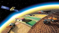
Precision farming
Precision farming - a set of measures aimed at improving productivity, reducing costs and preserving soil fertility potential using modern technologies and techniques:
- Differential sampling of soil samples:
- Field measurements
- Selection of soil samples by modern automatic equipment with allowance for zones of heterogeneity
- GPS snap to sampling points, which ensures high accuracy
- Agrochemical analysis of soil samples:
- Laboratory examination of soil samples for the content of macro-, meso-, microelements, humus and acidity level
- The analysis is carried out on modern equipment, according to the international standard ISO 17025
- Development of cartograms for the content of nutrients in the soil:
- With a clear location of each macro-, meso-, and microelement in the field
- With an indication of the exact level of acidity and humus according to the GPS coordinates on the field
- Based on the results of laboratory studies
- Development of nutrition recommendations for the active substance / physical weight of fertilizers:
- Development of recommendations by agronomists-soil scientists of a differentiated nutrition system for the active substance / in the physical weight of fertilizers
- Based on the results of laboratory studies
- Development of cartograms for fertilizer application in physical weight:
- Creation of an electron map of differentiated application of fertilizers to fields
- With considering of the heterogeneity zones with GPS-binding to the insertion points, which gives high accuracy and practical application
- Development of recommendations on the variable rate of seed sowing:
- Based on laboratory soil analyzes, recommendations are being developed on the variable rate of seeding
- Development of cartograms for a replacement seed rate:
- Creation of e-cards for removable seeding rate on individual parts of the field with GPS reference to points
- Identification of sealing zones on the field by an automatic penetrometer, which will allow:
- Affect on the development of the root system
- Increase the effectiveness of mineral fertilizers
- Ensure the penetration of moisture into deeper soil layers and avoid moisture stagnation on the soil surface
- Reduce the cost of cultivating the soil
- Satellite monitoring of fields:
- Satellite images are updated at least once every 5-15 days
- High accuracy of images - 5x5 meters, allows to identify the problem on the field in time and effectively take the necessary measures
- Biomass development maps are formed using the NDVI index (an indicator of the amount of photosynthetically active biomass) and taking into account the soil index (the mapping from the soil) and the puffed (the amount of chlorophyll in the green mass) indexes
- Agronomical support:
- Integrated management of agricultural producers in accordance with paragraphs 1-10 on the system of precision farming.